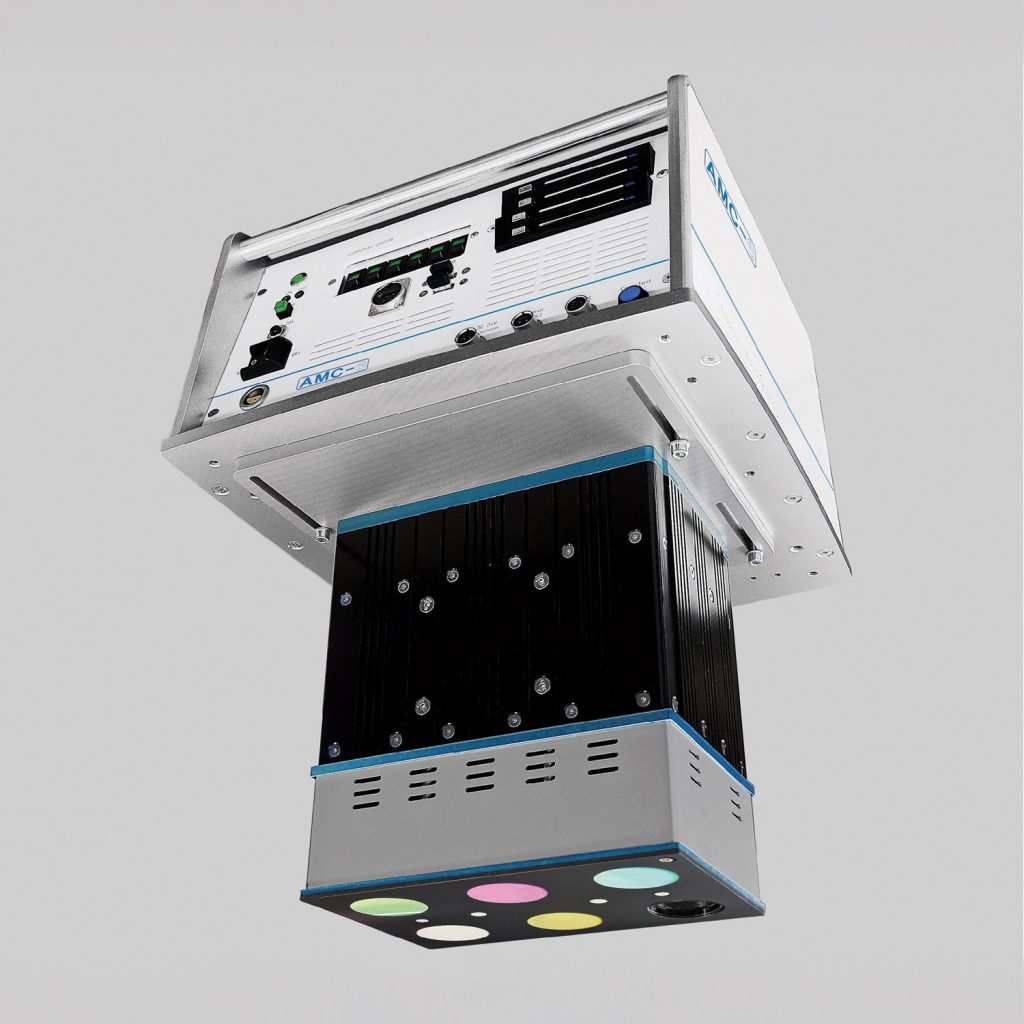
Research
Completed
Term: 03.2021 to 03.2024
AMC6 – Airborne Multispectral Camera
- Development of a multispectral, stand-alone camera system with customizable narrow and broadband filters for use in aircraft, gyrocopters or helicopters
- Application in environmental monitoring, forest condition monitoring, precision farming, yield estimation, as well as the derivation of water constituents or more
The project (funding code: KK 5252501 ER0) was funded by AIF Projekt GmbH as part of the Central Innovation Program for SMEs (ZIM).
Current:
- Device ready for use
- Software in development
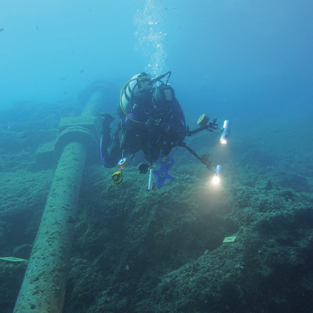
Method successfully tested
Term: 10.2022 to 02.2023
Student research project Geo-/referencing of 3D underwater structures using photogrammetry by scientific divers
- Georeferencing of 3D underwater structures using photogrammetry
- Development of a valid procedure for the application of photogrammetry in underwater environments by scientific divers. divers
- Evaluation, accuracy analysis and georeferencing of the data
Current:
- Reference applications in development
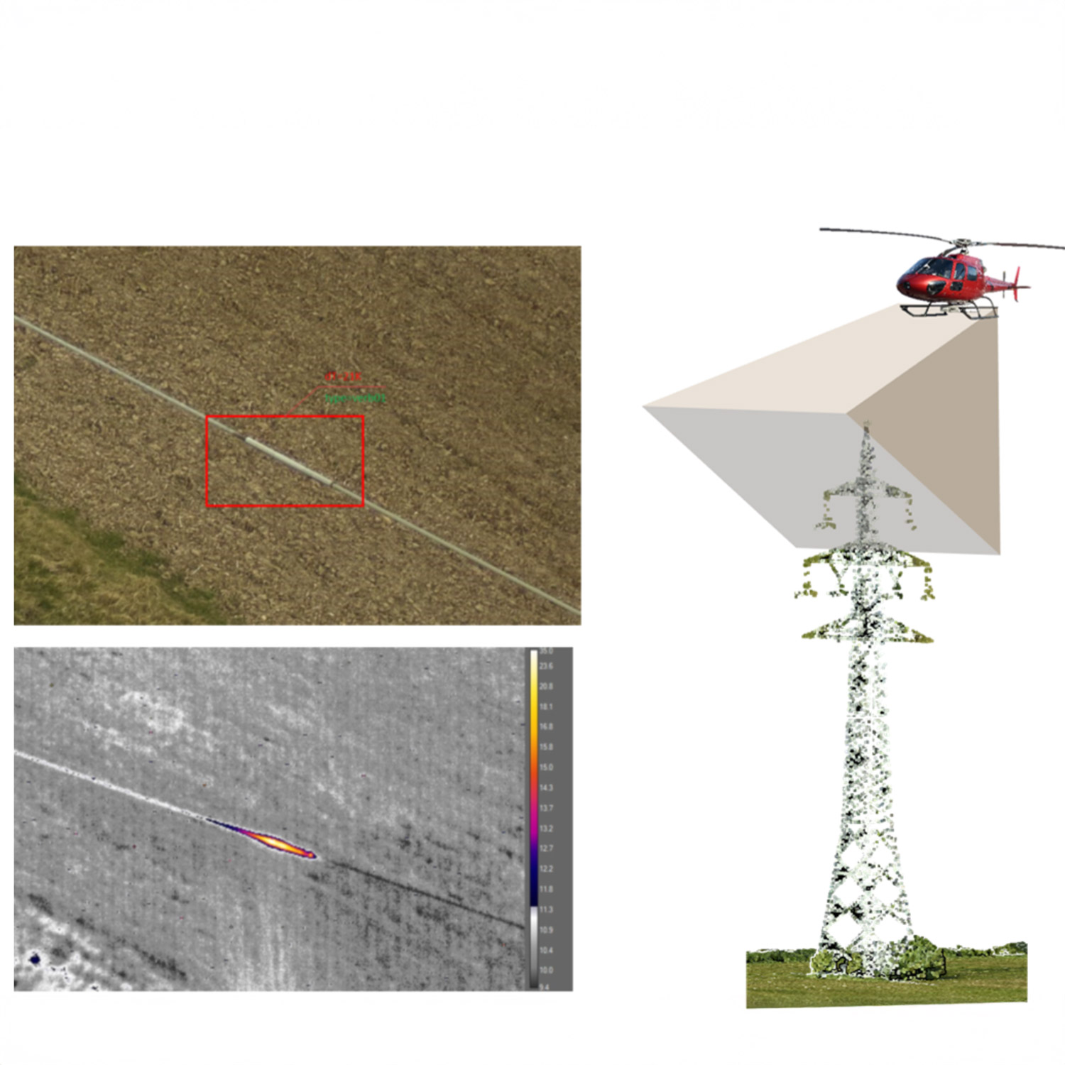
Completed
Term: 09.2020 to 08.2022
HiSTOS – High-speed thermography for online damage image capture
- Development of a thermal measurement system for use by a helicopter to detect damaged areas on power lines
- Data acquisition using RGB and thermal camera
- Automated classification of cable elements
- Derivation of the temperature at the object
Current:
- Reliable device in use
Completed
Term: 04.2016 to 12.2018
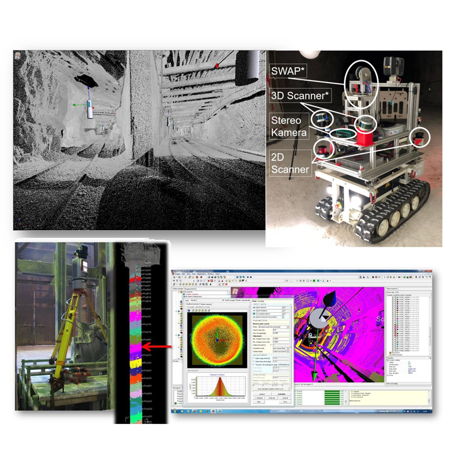
UPNS 4D+ – Underground 4D+ Positioning, Navigation and Mapping System Underground
- Autonomous driving robot including laser scanner and stereo camera for exploring storage locations
- Positioning and navigation system underground
- Warehouse exploration and documentation
The project was funded by the BMBF under grant number 033R126D.
Current:
- Device in use in research
Completed
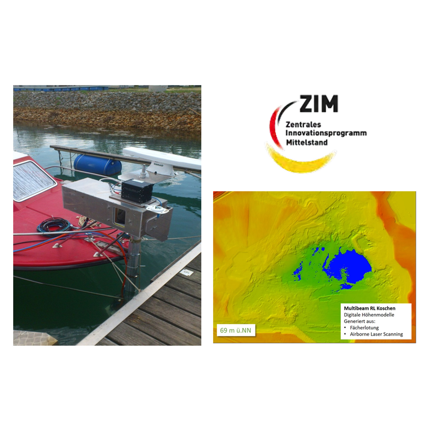
Duration: 07.2011 to 12.2013
HYFLES – HYbride fan plummet and laser scanning process
- Combination of multibeam echo sounder and laser scanner on one ship incl. positioning system
- Combination and calibration of data (software development)
- Up to 5 cm accuracy at 20 m shooting distance
- Recording of water bathymetry and integration of further sensor data
The combination of multibeam echo sounder and laser scanning has proven to be effective, but is too costly and not profitable for mobile real-time monitoring. Alternative applications are possible here.
Current:
- Application currently not being pursued